
- Navigator
- Prospecting and Business Attraction
- Real Estate Development and Housing
- Strategic Planning
 In the dynamic landscape of real estate and economic development, the ability to make informed decisions is critical. Geographic Information Systems (GIS) is a powerful tool that has become indispensable to professionals seeking to navigate the complexities of urban planning, economic development, housing analysis, and real estate development.
GIS serves as a spatial intelligence powerhouse, allowing professionals to visualize, analyze, and interpret data in a geographical context. Below are a few examples of how GIS is being used in real estate, housing, and economic development.
One of the primary applications of GIS in real estate is site selection. By layering demographic data, land use patterns, and infrastructure information onto maps, decision-makers can identify optimal locations for new developments or assess the potential of existing properties.
GIS brings clarity to the decision-making process, whether it’s choosing a retail location, evaluating the viability of housing projects, or planning industrial zones.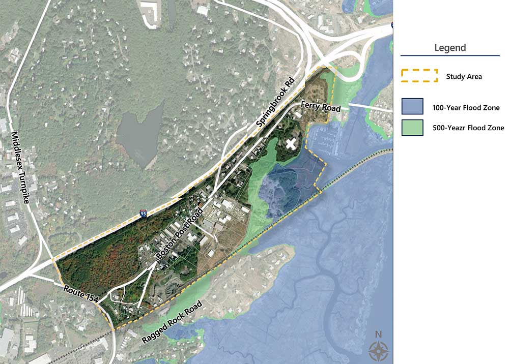
A map Camoin Associates produced for the Town of Old Saybrook’s Mariner’s Way Corridor Plan showing flood zones.
In economic development, GIS acts as a compass, guiding practitioners towards better-tailored programs, policies, and initiatives that address challenges that vary by geography. It can also highlight ways to capitalize on unique geographic opportunities.
By integrating economic data, employment statistics, and infrastructure details, GIS empowers communities to identify areas ripe for investment, job creation, and infrastructure development. This strategic approach fosters economic resilience and ensures that development initiatives align with the broader goals of the community.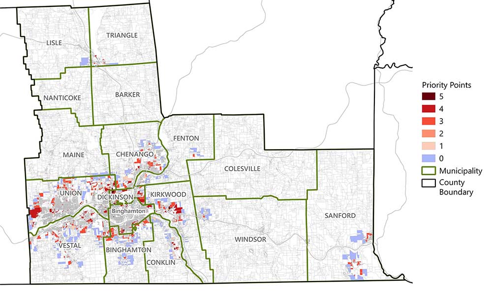
A map Camoin Associates produced for a Broome County, NY, housing needs study.
When it comes to housing, GIS is an invaluable tool in addressing the critical challenges of affordability, accessibility, and sustainability. Through GIS, planners can analyze housing market trends, identify housing demand hotspots and opportunity sites, and plan for the development of diverse housing types. GIS is also an excellent tool for developing affordable housing initiatives, mixed-use developments, and strategies for revitalizing existing neighborhoods.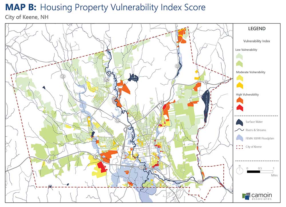
A map Camoin Associates produced for a housing study and strategy we completed for the City of Keene, NH.
GIS plays a pivotal role in identifying development and redevelopment opportunities by providing a comprehensive view of existing land use, zoning regulations, market trends, neighborhood characteristics, infrastructure, and other factors. This allows planners to pinpoint areas with untapped potential, whether it be for greenfield developments or the adaptive reuse of existing structures.
GIS facilitates the assessment of environmental factors, market conditions, and community needs, ensuring that development and redevelopment efforts align with the vision of a sustainable and vibrant community.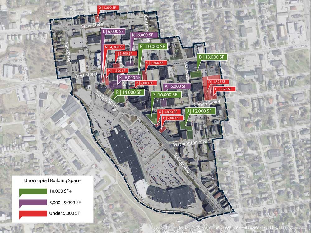
A map Camoin Associates produced for a downtown strategic plan we completed for the City of Rutland, VT.

Economic and Fiscal Impact Analysis
A recent analysis of a digital equity program in Westchester County, NY, revealed that it generated outsized economic benefits and return on investment for the community.

Business Retention and Expansion (BRE)

Industry Analytics and Strategy
Your resource for understanding today and looking toward tomorrow